
Bridge 109 and surrounding scenery
Bridge 109 was a footbridge that crossed the line literally above the diamond crossing of the junction. This connected Lower Laithe House below the line with its land above the railway. As the railway cut through the estate, this is likely to have been an obligation placed on the railway in the original Act of Parliament. The bridge would have been rebuilt and extended when junction with the Copy Pit line was moved towards the Millwood Tunnel. However the bridge suffered from a lack of maintenance, with a 1967 photo suggesting that there were significant gaps in the boarding and side panelling, such that BR removed it in 1973.
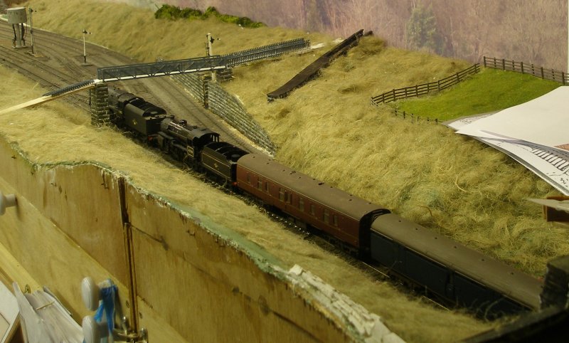
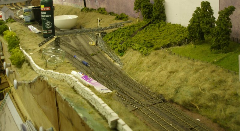
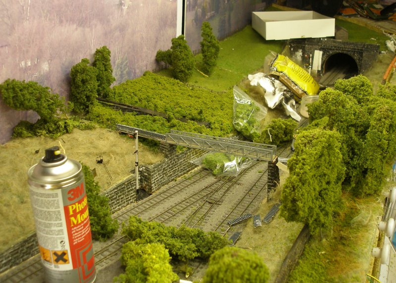
Hall Royd Junction (the model) showing the Kiln Clough culvert installed. Note the maps and photos being used for guidance. The train is the double headed Red Bank empty newspaper vans which passed Hall Royd at around 17:30 each evening. The use of a 9F is unusual but not unknown. Note the start of the dry stone wall at the bottom of the photo. This is constructed from DAS stones, formed by thinly rolling out a sheet of DAS, which is then cut into thin strips and then into individual stones. The stones are then glued using Bostick solvent-based (pink) or UHU.
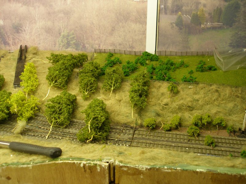
Hall Royd Junction (the model) showing the Kiln Clough culvert with Seafoam trees laid out.
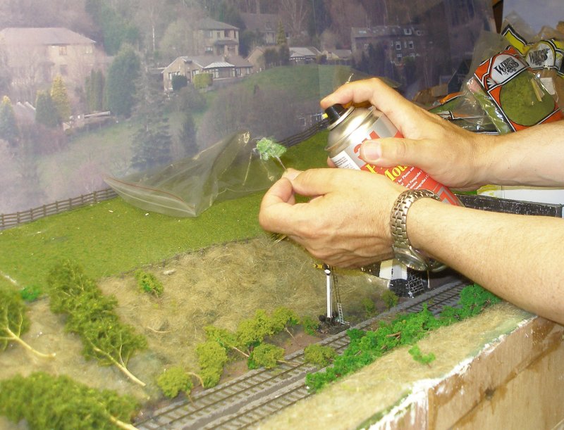
Hall Royd Junction (the model) showing the application of flock to the Seafoam trees, with the 'tree' being sprayed with Spraymount. It was quickly realised a better place was needed, so the job was completed in the garden.
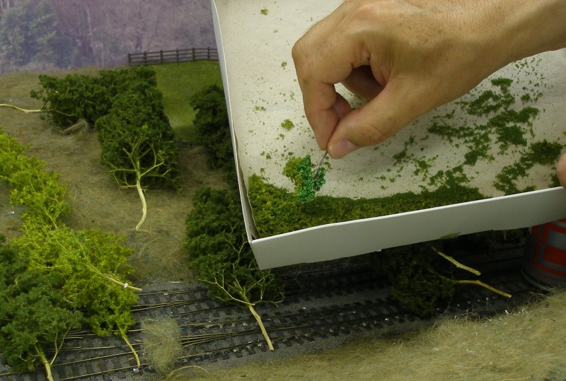
Hall Royd Junction (the model) showing the application of flock to the Seafoam trees. The flock is a mix of Woodland Scenics light green course turf and fine mid-green.
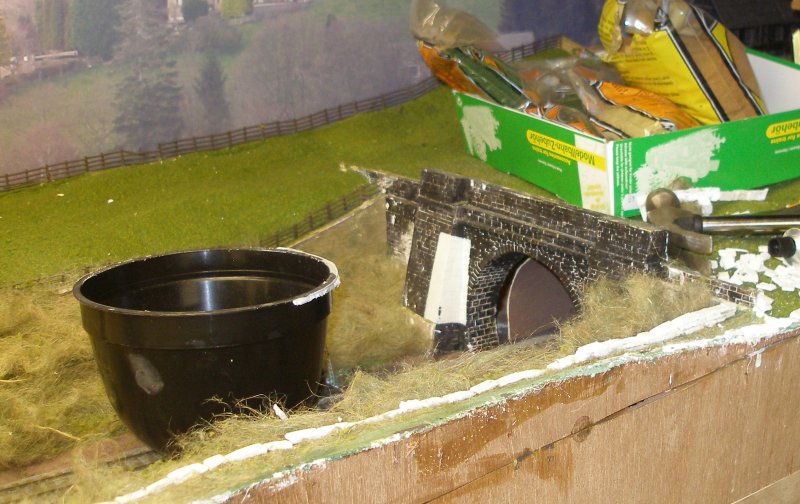
Before planting trees, the dry stone boundary wall needed to be constructed. About 7 foot of wall will ultimately be required. The stones are made from DAS. This is rolled out as a thin sheet (on cling film) and ten when dry cut into thin strips and then into 'stones'. These are then glued using either Bostick solvent-based (pink) or UHU.
The wall is clearly making steady progress. However, further study of Ordnance Survey maps suggested it needed to track further to the right, so the wall was separated from the underlying ModRoc, and re-glued in a better position. Note how the Seaform trees and bushes have been initially deployed around the culvert. This used up my entire initial stock of Seafoam, and clearly much more is needed. Study of photos shows that there are large areas of rough grass (hanging basket lining), with a large expanse of dense bushes either side of the culvert. Part of this is litchen flocked to look like the Seafoam. The finer grass in the field is my first stab at static grass.
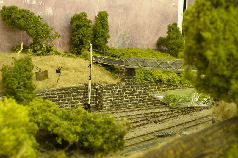
The greenery is advancing rapidly. The signal ladder can be seen lying on the embankment. This is unusual in that it is in two parts: the first part is attached to the retaining wall, and end in a small landing on top of the wall. The second section is then attached to the front of the post.
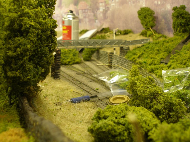
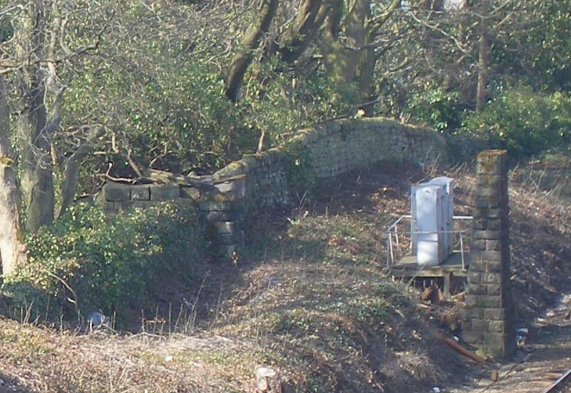
The wall is painted, and the 'forest' surrounding Lower Laithe House is starting to form up. For interest, here's a snap of the prototype from a similar location.
The 'greening' of the area round Bridge 109 from the west.
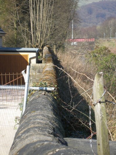
As the bridge was removed by BR in 1973, and was on private land, good photographs of it have yet to come to hand. However, the piers still exist, and the photo below shows how the bridge was integrated with the stone wall.
Abutment and pier of Calder Valley main line bridge 109. The bridge number has been crudely painted on the pier. Note how the left hand bridge span landed on a stone pier built on the boundary, and higher than the stone wall. The OS maps show that access to this pier was via an embanked path that turned to the right, and then reversed to end at ground level immediately behind the pier, and next to the exit from the Kiln Clough culvert.
Posted 14 August 2015
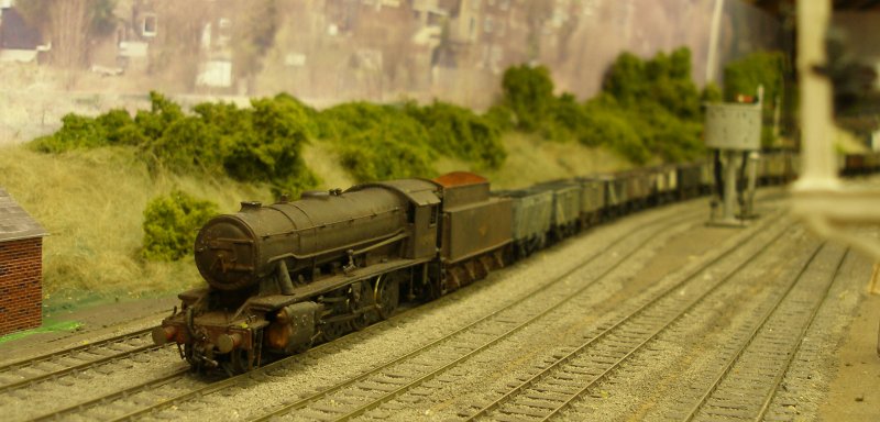
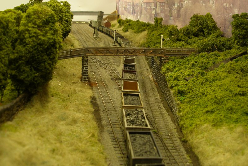
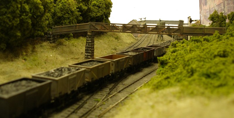
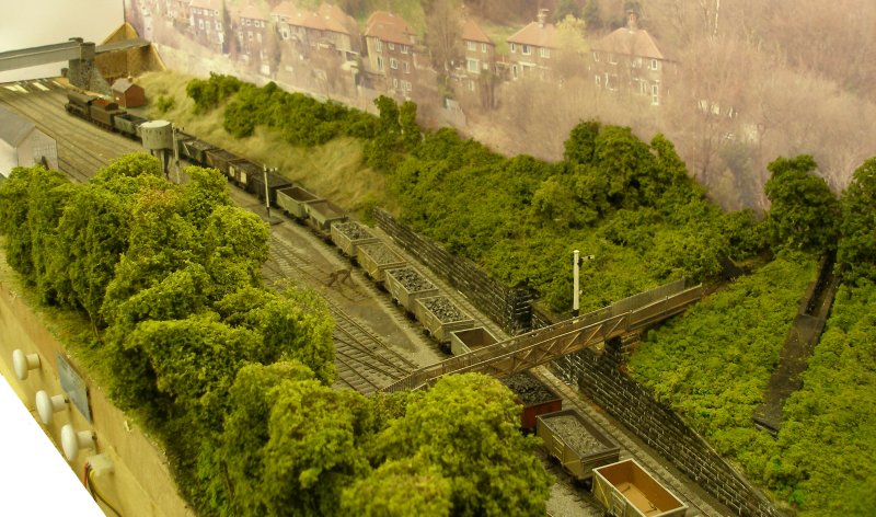
A couple of weeks more, and the scene is starting to flesh out. Here are four shots taken on 4 September 2015 showing footbridge 109, the Kiln Clough culvert, and the coppice that surrounds listed building Lower Laithe House. Goole's WD 2-8-0 90099 works a loaded coal train across the junction and onto the Copy Pit line bound for Rose Grove. As the layout ends in a return loop, the train will shortly been seen returning down either the second or third tracks from the right, which represent the Down LYR main and Down Goods loop respectively. On-going photo research suggests that the water tank was 'bagless' from at least 1954, so the various accessories will have to be removed.
Copyright J K Wallace, t/a 'Hall Royd Junction' 2013-2023 email: Hall Royd Junction
7 Portobello Close, Chesham, Bucks. HP5 2PL, UK
tel: +44 (0)7513 412880