
Liverpool - Southport Line: Hillside-Freshfield
(Merseyrail Northern Line)
Our journey today starts at Southport Chapel Street and follows the line to the site of the erstwhile Liverpool Exchange using Google Streetview images. Should you use the individual Google navigation tools, and wish to restore the page to its default views, just refresh the page.
As it takes a few seconds for each of the Google maps to be retrieved, the line is broken into sections, and generally these are station-to-station. Each Google Streetview image is presented facing the direction of travel, in this case southwards. The intention is that to see the northwards view, the Google navigation tool needs to be used.
The section south from Hillside crosses some of Southport's famous golf links, and so suitable Streetview locations only occur in the last half mile before Ainsdale Station.
Ainsdale always had the appearance of an after-thought, with a temporary looking collection of buildings and lattice footbridge - in complete contrast to Birkdale.
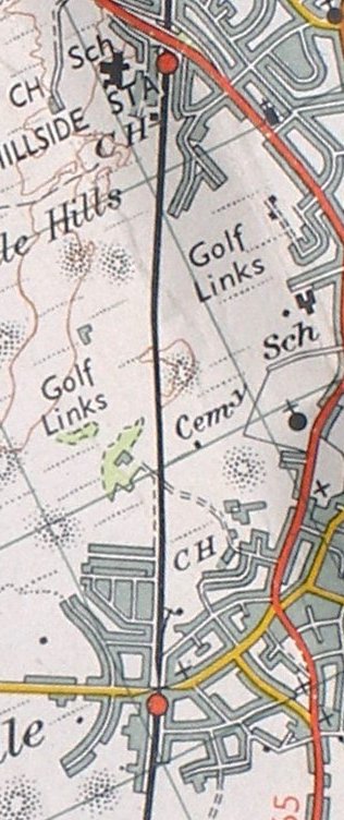
Reproduced from the Ordnance Survey 1961
For the next section of line from Ainsdale to the Coastal Road, click the link...
Copyright J K Wallace, t/a 'Hall Royd Junction' 2013-2023 email: Hall Royd Junction
7 Portobello Close, Chesham, Bucks. HP5 2PL, UK
tel: +44 (0)7513 412880