
Liverpool - Southport Line: Bootle Oriel Road - Bank Hall
(Merseyrail Northern Line)
Our journey today starts at Southport Chapel Street and follows the line to the site of the erstwhile Liverpool Exchange using Google Streetview images. Should you use the individual Google navigation tools, and wish to restore the page to its default views, just refresh the page.
As it takes a few seconds for each of the Google maps to be retrieved, the line is broken into sections, and generally these are station-to-station. Each Google Streetview image is presented facing the direction of travel, in this case southwards. The intention is that to see the northwards view, the Google navigation tool needs to be used.
Bootle Oriel Road is another station fully upgraded in recent years.
Out of Oriel Road, and rising up from the left in the ex-LNWR line to the docks - the last remaining connwection - and now connecting Seaforth Container Terminal with Edge Hill. Miller's Bridge crosses both sets of tracks.
There is now a slight deviation, as we use Streetview to show the view above the LNWR tunnel.
King's Road parallels both the LNWR and L&YR lines at this point, before Bootle Junction is passed, and the LNWR line disappears back into tunnel to re-emerge in a deep cutting behind the site of Bank Hall loco shed.
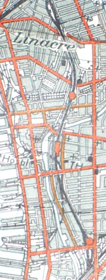
Reproduced from the 1961 Ordnance Survey map.
Copyright J K Wallace, t/a 'Hall Royd Junction' 2013-2023 email: Hall Royd Junction
7 Portobello Close, Chesham, Bucks. HP5 2PL, UK
tel: +44 (0)7513 412880