
Manchester - Southport Line via Wigan and Bolton: Meols Cop - Burscough Bridge Junction
Our journey today starts at Southport Chapel Street and follows the line to Manchester Victoria via Bolton using Google Streetview images. Should you use the individual Google navigation tools, and wish to restore the page to its default views, just refresh the page.
As it takes a few seconds for each of the Google maps to be retrieved, the line is broken into sections, and generally these are station-to-station. Each Google Streetview image is presented facing the direction of travel, in this case eastwards. The intention is that to see the northwards view, the Google navigation tool needs to be used.
View Larger Map
Crowland Street brigde is of note for two reasons: firstly the headshunt noted earlier curved down at this point to join the road through a gate, and secondly, the track formed a junction with the line coming along from the direct Manchester-Southport line at Hart Street, so at this point there were tracks both on and under the bridge.
Pool Hey level crossing and junction: to see the site of the junction you will need to spin the camera to view the site of the junction. Gordon Walker, the founder of Steamport Southport and now associated with the Preston Steam Railway, had film footage of the signals being worked for both routes the day after the direct line was closed, the signalman setting the route for St Lukes, and then reversing the route, and pulling the signals for Meols Cop. When barriers were first located on the moss there were problems with the foundations, and so barriers and gates co-existed for some time. The crossing keeper's house was on the north-western corner of the crossing and was a grey pebble-dashed two-storey house.View Larger Map
Wyke Lane crossing with barriers and relay room.
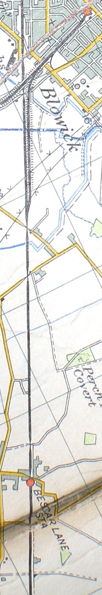
Reproduced from the Ordnance Survey Map 1961
Copyright J K Wallace, t/a 'Hall Royd Junction' 2013-2023 email: Hall Royd Junction
7 Portobello Close, Chesham, Bucks. HP5 2PL, UK
tel: +44 (0)7513 412880