
Manchester - Southport Line via Wigan and Bolton: Parbold - Appley Bridge
Our journey today starts at Southport Chapel Street and follows the line to Manchester Victoria via Bolton using Google Streetview images. Should you use the individual Google navigation tools, and wish to restore the page to its default views, just refresh the page.
As it takes a few seconds for each of the Google maps to be retrieved, the line is broken into sections, and generally these are station-to-station. Each Google Streetview image is presented facing the direction of travel, in this case eastwards. The intention is that to see the northwards view, the Google navigation tool needs to be used.
So far the line has been crossing the moss, with its long straight flat run out of Southport, but now for the first time it encounters a hill: and not any hill, as this is the road up Parbold Hill. Originally considered a steep hill for early motorists, many early cars could only go up it in reverse.
Chapel Lane crossing is another delight, for not only is there an original crossig keeper's house, but the crossing is still gated.
Appley Bridge station had a narrow gauge feeder from an explosives factory on the other side of the valley, behind the station, which also featured a steel viaduct. A reversal of the camera will show a turnout leading to a siding, and for the first time in this series, an approaching train.
View Larger Map
Mill Lane sports an overbridge.
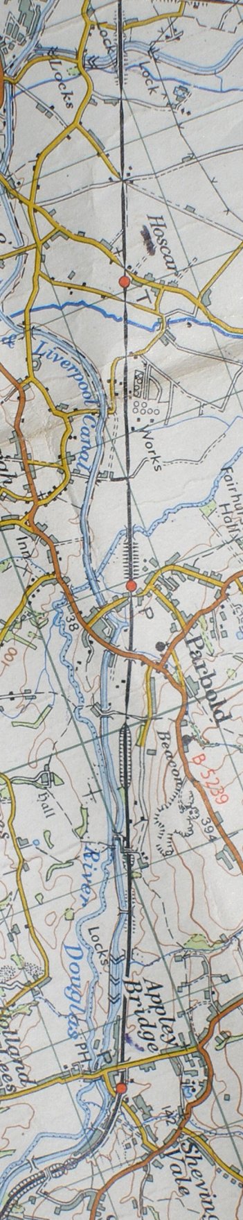
Reproduced from the Ordnance Survey Map 1961
Copyright J K Wallace, t/a 'Hall Royd Junction' 2013-2023 email: Hall Royd Junction
7 Portobello Close, Chesham, Bucks. HP5 2PL, UK
tel: +44 (0)7513 412880