
Manchester - Southport Line via Wigan and Bolton: Scott Lane bridge - Wigan Wallgate
Our journey today starts at Southport Chapel Street and follows the line to Manchester Victoria via Bolton using Google Streetview images. Should you use the individual Google navigation tools, and wish to restore the page to its default views, just refresh the page.
As it takes a few seconds for each of the Google maps to be retrieved, the line is broken into sections, and generally these are station-to-station. Each Google Streetview image is presented facing the direction of travel, in this case eastwards. The intention is that to see the northwards view, the Google navigation tool needs to be used.
Scott Lane Bridge, Wigan.
Beresford Street bridge, Wigan.
Prescot Street bridge, Wigan.
View Larger Map
Wigan Wallgate Station platforms.
Wigan Wallgate: the back of the station buildings
And finally the frontage of the station building canopy. In the journey from Southport via Google Streetview there has been a surprising number 'old' railway artifacts in surprisingly good order, including two L&YR signal boxes, a number of crossing keeper's house and station buildings; and here in Wigan, a little gem of an original Lanky town centre station.
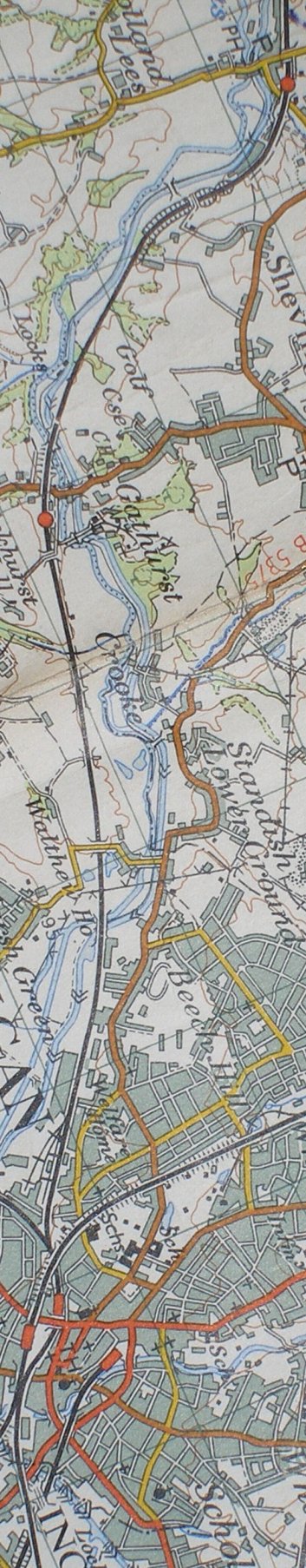
Reproduced from the Ordnance Survey Map 1961
Copyright J K Wallace, t/a 'Hall Royd Junction' 2013-2023 email: Hall Royd Junction
7 Portobello Close, Chesham, Bucks. HP5 2PL, UK
tel: +44 (0)7513 412880