
Liverpool - Southport Line: Southport Chapel Street - Eastbank Street bridge
(Merseyrail Northern Line)
Our journey today starts at Southport Chapel Street and follows the line to the site of the erstwhile Liverpool Exchange using Google Streetview images. Should you use the individual Google navigation tools, and wish to restore the page to its default views, just refresh the page.
As it takes a few seconds for each of the Google maps to be retrieved, the line is broken into sections, and generally these are station-to-station. Each Google Streetview image is presented facing the direction of travel, in this case southwards. The intention is that to see the northwards view, the Google navigation tool needs to be used. To have incorporated both north and south views would have made the page very slow loading.
Chapel Street, Southport. In the old days, the street outside the station allowed a bus interchange with many southbound services stoping just south of the station side entrance. Going north was less successful and involved a hike down London Street to the Monument. Google tends to only send the camera van out on sunny days, and the rather austere exterior provided by BR in the 1970s, needs all the sun it can get.
Platforms 8 - 11 and the cab rank exiting onto London Street, with its two gated entrances , were demolished as part of the rebuild. In their place appeared the entrance to a car park which extended beyond the footprint of the original platforms. There were concerns that the trainshed without its supporting northern wall would be unstable, and a steel framework was added to the trusses to give the remaining structure some rigidity.
The original boundary wall survives further down London Street. The Liverpool platforms are covered by the two furthest gables of the trainshed.
Trains leaving for Liverpool take a sharp right hand curve passed the site of the old signal box before passing under Eastbank Street bridge. In the distance can be seen the first level crossing at Portland Street. Spinning the camera roud and looking back towards Southport the remains of the triangle and stock storage sidings are evident.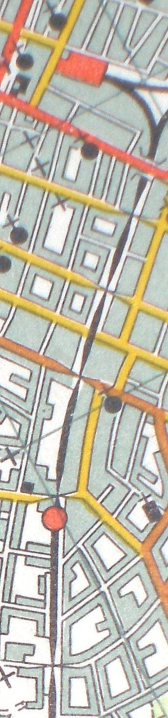
Reproduced from the 1961 Ordnance Survey map.
Copyright J K Wallace, t/a 'Hall Royd Junction' 2013-2023 email: Hall Royd Junction
7 Portobello Close, Chesham, Bucks. HP5 2PL, UK
tel: +44 (0)7513 412880