
Liverpool - Southport Line: Eastbank Street bridge - Birkdale
(Merseyrail Northern Line)
Our journey today starts at Southport Chapel Street and follows the line to the site of the erstwhile Liverpool Exchange using Google Streetview images. Should you use the individual Google navigation tools, and wish to restore the page to its default views, just refresh the page.
As it takes a few seconds for each of the Google maps to be retrieved, the line is broken into sections, and generally these are station-to-station. Each Google Streetview image is presented facing the direction of travel, in this case southwards. The intention is that to see the northwards view, the Google navigation tool needs to be used.
The first level crossing out from Chapel Street was Portland Street, which had a Lancashire & Yorkshire Railway signal box located to the left of the crossing gates, in the space between the road and the surviving brick PW hut. Spin the navigation button and looking in the opposite direction is the original station building, which remarkably has survived and now houses the Southport Model Railway Club.
Duke Street also featured a L&YR signal box, but the box was still on the 'country' side of the tracks buit on the Southport side of the crossing.
Aughton Road interestingly had a Midland Railway signal box, suggesting it had been replaced soemtime after the grouping in 1923. The initial mile of straight track now gives way to gentle curve to the east as the tracks head for Birkdale.
This section ends at Birkdale, and this Google Streetview breaks covention and is orientated northwards to show the splendid signal box, which is now 'preserved'. Although of L&YR origin, it's non-standard in many ways, and so a wonderful surviving example. The railway crosses Weld Road to enter Birkdale Station.
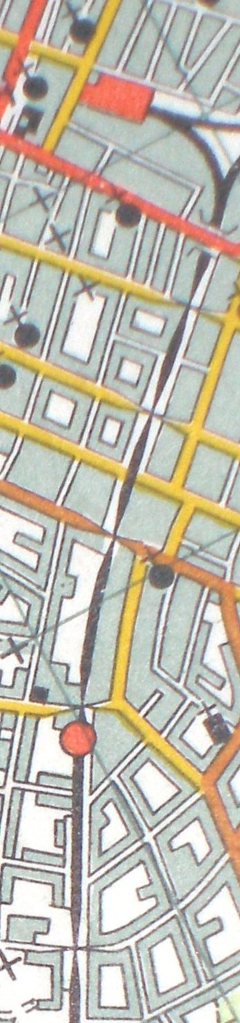
Reproduced from the 1961 Ordnance Survey map.
Click here for the Birkdale - Hillside section.
Copyright J K Wallace, t/a 'Hall Royd Junction' 2013-2023 email: Hall Royd Junction
7 Portobello Close, Chesham, Bucks. HP5 2PL, UK
tel: +44 (0)7513 412880