
The Low Moor and Clifton Colliery Tramways - Clifton
Low Moor Tramway: History Low Moor Tramway: Route Low Moor Tramway: Track & Inclines Low Moor Tramway Mapping
This review starts with the Clifton Colliery Tramway, which was subsequently acquired by the Low Moor Ironworks, before dealing with the centre of operations at Low Moor. The reason for this is two-fold: this article appears on a Calder Valley orientated Website, and secondly, the Clifton Colliery line is rarely dealt with in its own right.
For those researching these tramways there was a Website dedicated to Low Moor and its industries at http://www.lmlhg.org.uk/lowmoor/Ironworks.html; however, the link is now broken. This provided a comprehensive collection of photographs of the Low Moor Works.
However, all is not lost, as the WayBackMachine Archive has captured most of the pages: see http://web.archive.org/web/20200225133944/http://www.lmlhg.org.uk/lowmoor/Ironworks.html
The site noted that the Low Moor Ironworks was established around 1790, and then grew rapidly. The rapid rise in the number of employees caused a great increase in the local population and the need for housing, churches, shops, pubs and public buildings: in fact, a whole township. The Low Moor rail and tramway system was extensive, although branches were opened and closed with great regularity: the full extent of the system can be viewed here overlaid on modern Ordnance Survey mapping, along with gradient profiles..
Clifton Colliery Railway
According to Malcolm Bull's Calderdale Companion, the Clifton Colliery Railway was built in 1834-1835 by brothers Benjamin and Edmund Walker to transport coal from the mines at Clifton, and closed in 1928. However Margaret Sharp [9] records that the line from Ox Pit to Brake Head and down the incline was last used in 1920 when the lease expired on 29 February 1920. Sharp records that negotiations for a sale started in January 1920 and in June the section of the tramway between Armytage Road and Wakefield Road in Brighouse was sold to Ramsden Camm & Co. An old stable block on Wakefield Road sold for £10.
Edmund died in 1855 and Benjamin apparently surrendered the mining lease. The mines were subsequently worked by the Low Moor Iron Company, who acquired them in 1860-61[9], and the Low Moor tracks reached Ox Pit in 1886
The 1834 date means that Clifton is a contemporary of the horse-worked Ffestiniog Railway that obtained its Act of Parliament on 23 May 1832. A few years earlier the Nantlle Railway (sometimes known as the Nantlle Tramway) received its Act of Parliament in 1825 and was constructed by Robert Stephenson, son of George Stephenson. It opened in 1828 using horse power. The line - remarkably - not only survived in its original form but also, when it closed in until 1963, was a part of the nationalised British Railways operation. It is the last recorded use of horses by BR, and closed only when the branch line it was connected to closed. Also of note in North Wales is the Penrhyn Railway,
There are also similarities with the Penrhyn Quarry Railway which dates from 1801 and linked the Penrhyn slate quarries at Bethesda with Port Penrhyn, a distance of some six miles. The railway consisted of four level plains divided by three inclines. Track featured iron edge rails three feet long and supported on slate and stone blocks. The railway was operated by horses working between the inclines pulling up to around twenty loaded waggons.
These three early railways set the scene for what was created at Clifton. The surviving stone block 'sleepers' in the boundary walls with their single hole drilled centrally suggest a trackage very similar to that described for the Penryhn. However, Clifton may have had the edge on these three early systems by employing rope haulage on the level sections from the start.
An early eyewitness report records the strange, and slightly unnerving, sight of a of raft of couves moving across the landscape without obvious means of propulsion.
Coal was conveyed from the Clifton Colliery and Clifton New Colliery (later Ox Pit) and ran down the hill, running parallel to Clifton Common, and passed beneath the road and down to Brighouse canal basin. In 1886, after Clifton Colliery had been taken over by the Low Moor Iron Company, the railway was connected to their tramway system and which then took coal northwards to their works.
The waggons were hauled by ropes, driven by a series of winding houses located at strategic points. A small tunnel carried the tramway beneath Birkby Lane (the A649), the site now marked by a short brick wall on the southern side of the road. Later, there were branch lines to Pheasant Pit, Hartshead, Whitaker Pits, Clifton, and Three Nuns Pit, Hartshead [1905].
The Clifton Colliery tracks were laid to 3 foot gauge, whilst the Low Moor system proper was 3 foot 10½ inches. The tramway from Low Moor had reached Ox Pit and the Clifton Colliery lines by 1886 [9]. The Brighouse - Ox Pit section was subsequently fitted with a third rail to accommodate couves of both gauges [9].
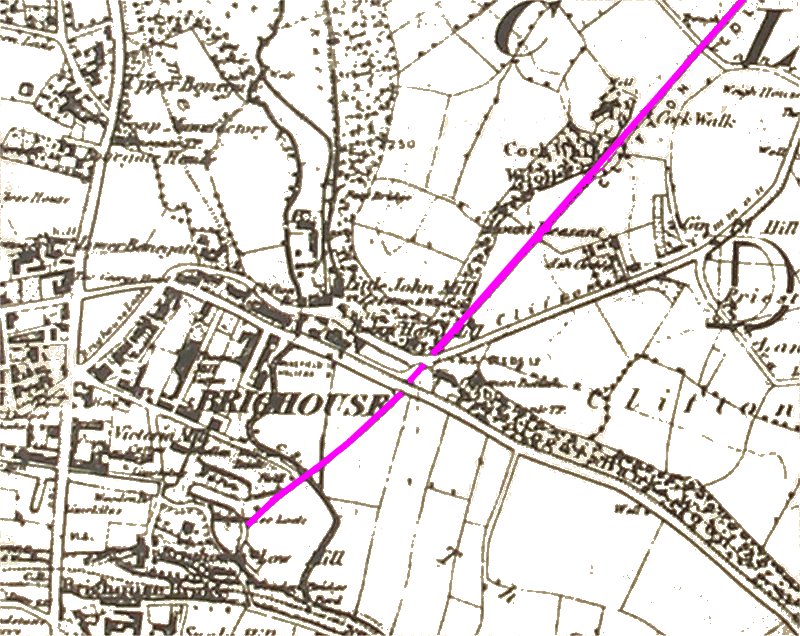
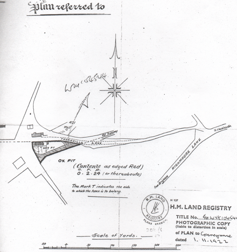
The map below, extracted from the 1854 Ordnance Survey County Series, shows the tramway in its early form - the map until recently hung in Ox Close. Brighouse Gas Works was strategically built next to the Calder & Hebble canal basin, and at the end of the tramway. Malcolm Bull's Calderdale Companion records that the Mill Lane Gas Works opened in 1857, and became a part of the North Eastern Gas Board after nationalisation of the gas industry in 1949. Production stopped on 14 April 1954. The 1900 mapping shows two turntables that allowed waggons to be turned so that they could be pushed into the Works. It is suggested that coal continued to be trucked down to the Gas Works until the last pit closed in 1928. The title deeds record that the housing (the modern Ox Close) at Ox Pit was sold off on 1 November 1922.
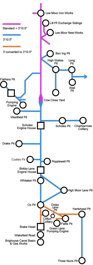
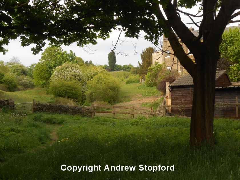
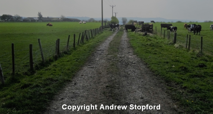
The tramway started at the Brighouse canal basin and crossed the end-on junction of Mill Lane/Armytage Road on the level before cutting diagonally across the block formed by Grove Street and George Street before crossing Wakefield Road to the foot of the incline. I am grateful to Andrew Stopford, who has kindly allowed me to share the photographs he has taken recently taken showing various features of the tramway (the full set can be viewed on his Flickr page).
Andrew's first shot shows the canal wharf in Brighouse, close to the site of the Gas Works. The mapping suggests the tracks were end-on to the canal.
Copyright Andrew Stopford, All rights reserved.
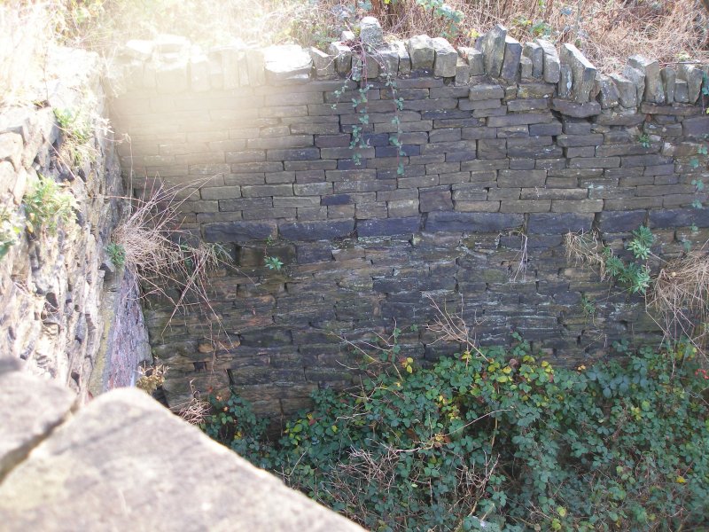
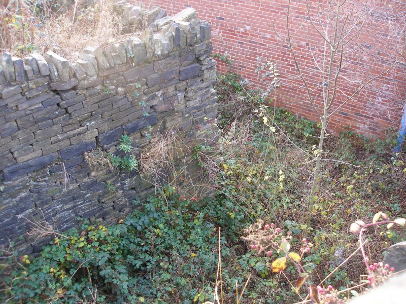
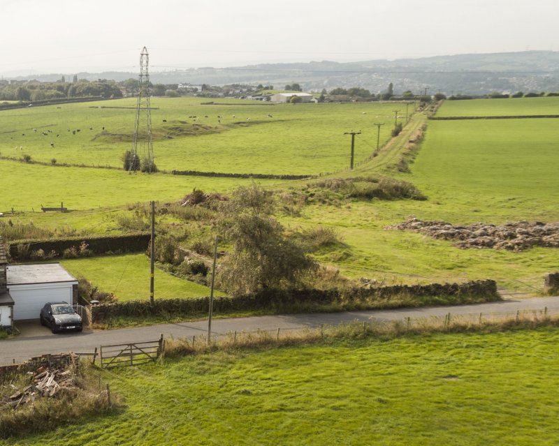
The tramway crossed on a bridge, which survives, and is captured in the next three shots. To get the orientation, the small white van appears in all three shots.
Copyright Andrew Stopford, All rights reserved.
Copyright Andrew Stopford, All rights reserved.
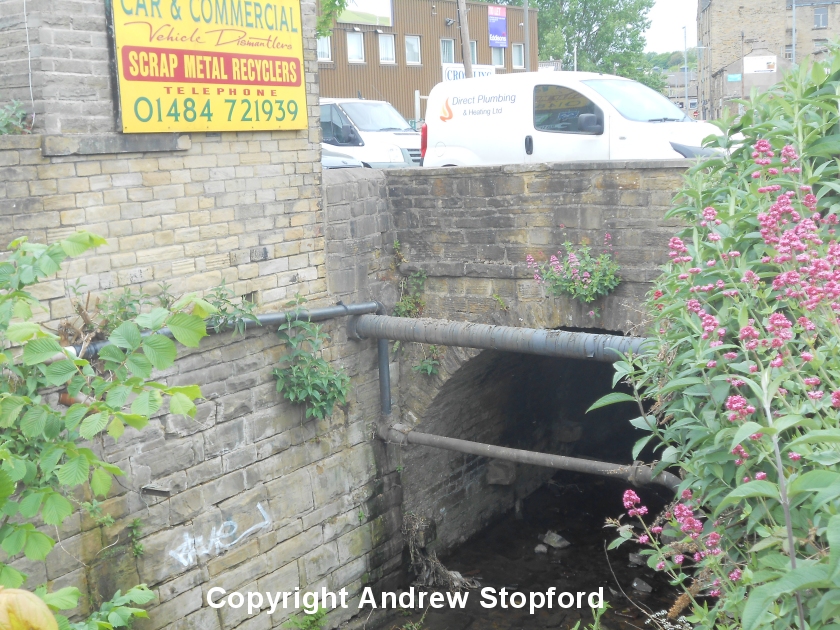
Copyright Andrew Stopford, All rights reserved.
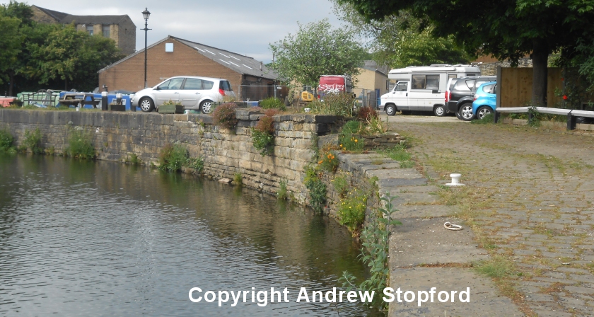
The incline rose from Wakefield Road through the site of what is now the 'Home Improvements' warehouse before entering a stone lined cutting. From the mapping, and particularly the Ordnance Survey sheets in the 1890 - 1920 period, the tracks are shown crossing over the road, via a level crossing. However, as the map below shows, in earlier maps the tramway is shown passing under Wakefield Road. The 'Britain from Above' Website has a photograph of the Samuel Driver Warehouse taken in 1936 which gives the suggestion of a bridge under Wakefield Road.
I’ve always thought that the level crossing would have been something of a nine-day wonder in the town and would have featured in local postcards. However, even in Victorian times the Board of Trade was concerned about public safety, and the bottom of an incline with cables across the public highway would have come to their attention, with regulations certainly being imposed. And there would certainly have been a run-away (rope or coupling failure) at some point that the local press would have leapt on. Instead, the incline in Brighouse might well have been out of sight and mind of the good people of Brighouse, tucked away in its narrow cutting. Confirmation of this point would be most welcomed.
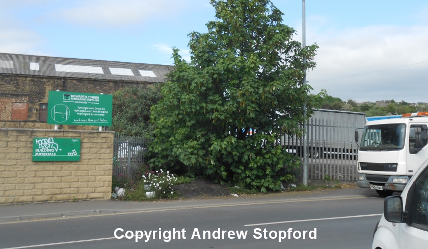
Andrew's photo of Wakefield Road suggests that the road rises to the point at which the tramway crossed it. This could support the theory that this was to accommodate the bridge underneath, or the levels could have been adjusted so that the tracks at the bottom of the incline crossed the road on the level!
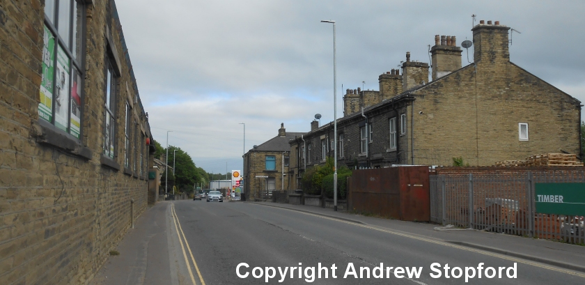
Copyright Andrew Stopford, All rights reserved.
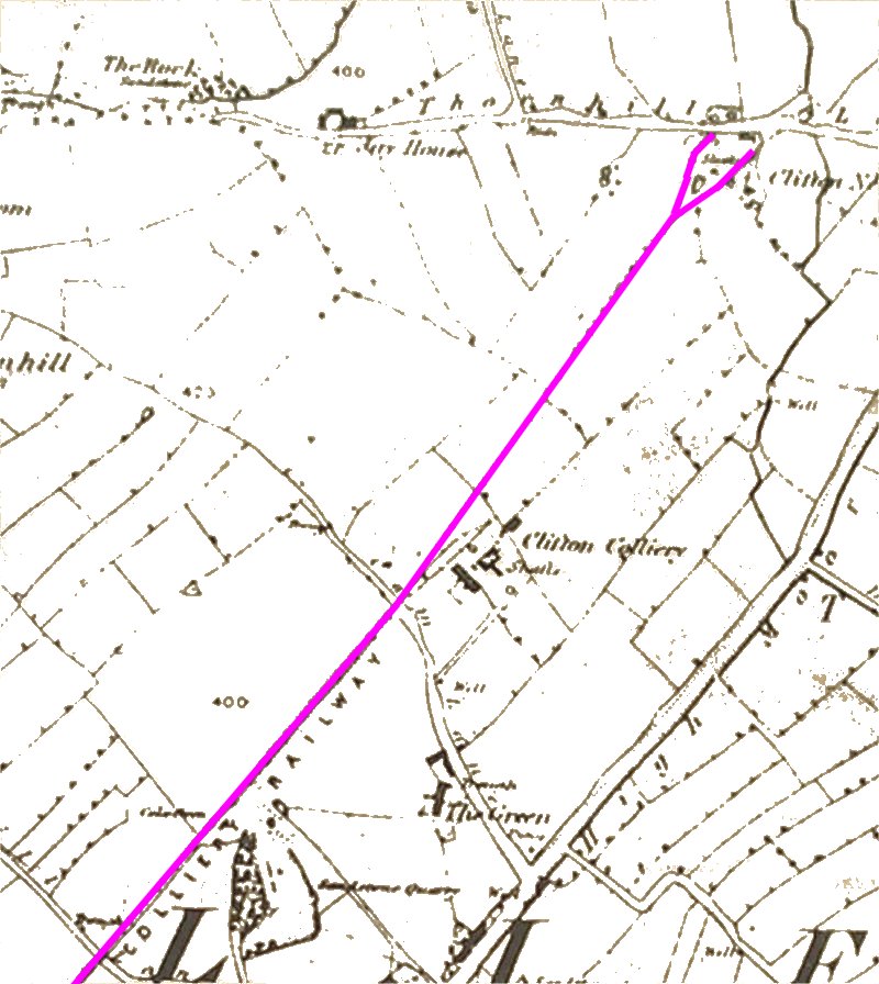
This led directly to a tunnel under Clifton Road/Common, which is now bricked up. At the northern side the tunnel ended close to the arches of the Lancashire & Yorkshire Railway's Pickle Bridge line viaduct, which it passed through on its way to the winding house at Brake Head, as shown on the 1900 Ordnance Survey mapping, but spelt Breakhead on Low Moor Company mapping. The Colliery Railway pre-dated the Pickle Bridge line, as can be seen from the map extract below.
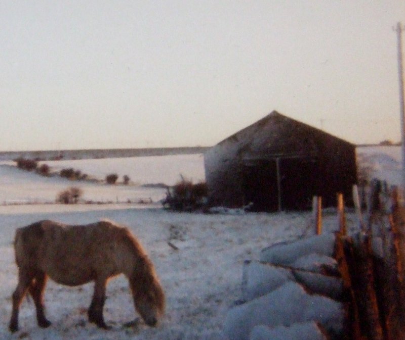
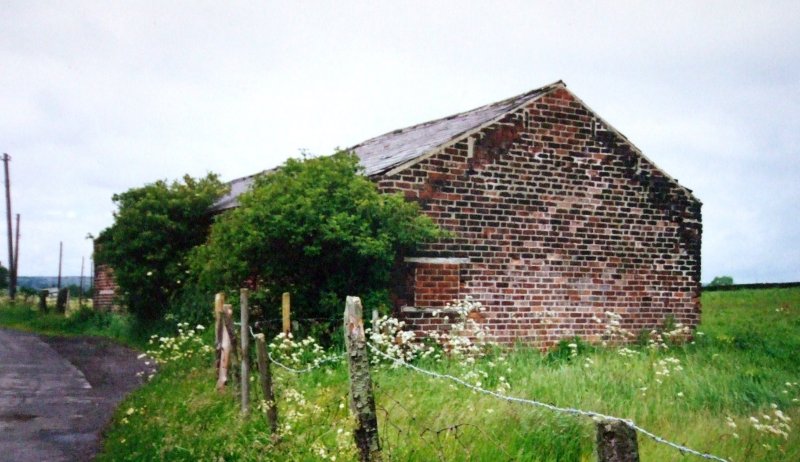
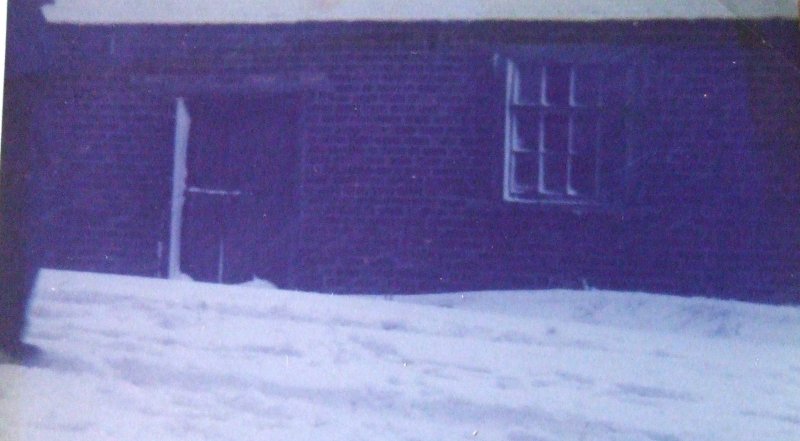
From the top of the incline the line then crossed Clifton Common on a low embankment formed with stone walling on either side (in the manner of the Ffestiniog or Cromford & High Peak). It passed Clifton Colliery before terminating at Clifton New Colliery/Ox Pit on what is now Jay House Lane. The three cottages that formed part of the colliery complex survive to the present day and form the current Ox Close. Until relatively recently a one-story brick-built 'barn' survived next to the road directly opposite Ox Close, and the brickwork is still evident by the roadside (December 2016). Part of the building had stalls for horses, and it may well have stabled the tramway's shunting horse.
In its original form, the tramway split to form a wide 'Y' as it approached Ox Pit, with the arms passing either side of Ox Close and terminating by the road. Chris Helme in the Brighouse Echo [10] notes that Ox Pit is one of a number of pits in the Clifton area that figures on a map of 1851 as working mines, but notes "a number of them had closed due to either water problems or them having been worked out or become unviable". Of relevance to the Low Moor railways, Helm also notes that the 'Selections of Strata of the Coal Measures of Yorkshire', published in 1927, shows the only working mines as Battyeford (Three Nuns 1882 - 1928); Coates Pit opened in 1872 and Highmoor Lane opened in 1865. Accompanying the article is a map showing 'The Fields of Clifton 1788', which shows 'Ox Close' as an irregular shaped field on what was then called Thornhill Lane, but is now the modern 'Jay House Lane'.
Alec Oldroyd writes that his first house was on Wakefield Road, Brighouse and that from the upstairs you could see into a hidden space behind a factory and a narrow tunnel under Clifton Road.
Photographer & Copyright: J K Wallace
Photographer & Copyright: J K Wallace
A friend of Alec's lived at Brakehead Farm higher up the hill, where there had been a large drum brake here to control the co-acting incline. Alec reports that from Wakefield Road, an alley ran at an angle to the canal basin where rails were visible 20 years ago (1996).
The demolition of the L&YR viaduct appears to have buried the remains of the uphill tunnel entrance. The Huddersfield Daily Examiner has a full set of photos by Stuart Black showing the L&YR viaduct prior and during demolition in late February 1974. Unfortunately, the arch under which the incline passed is not shown in detail, and the incline is therefore not visible.
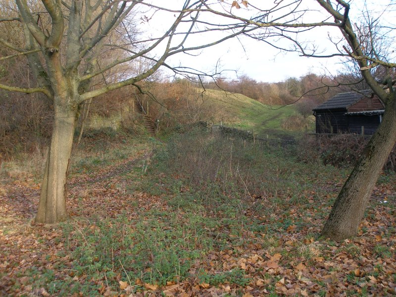
The incline passed up behind the houses on Clifton Common, and its course in the image below is from bottom left to centre right, the muddy path being on the alignment. The second photo is taken to the left of the first.
Photographer & Copyright: J K Wallace
Copyright Andrew Stopford, All rights reserved.
At the top of the incline was the engine brake house. At Clifton, the predominant traffic was downhill from colliery to canal wharf, and latterly, the gas works. There would have been some backloads, such as pit props and provisions from the mining community, but the volume of such loads would been comfortably covered by the volume of coal descending the incline. Consequently the 'brake head' at Clifton would have literally been that; a large drum with a brake to check the speed of traffic descending the incline, and it would not have featured a steam-powered winding engine, as elsewhere on the Low Moor system. The top half of the incline consisted of two tracks, and three rails (the middle rail being common to both tracks), and then on the lower half, a single track. A passing loop (two tracks with no shared, middle rail) facilitated the transition between the two sections. This arrangement allowed a 'raft' to be simultaneous dispatched from top and bottom, with the Clifton-bound loaded couves pulling the empty vehicles uphill, and passing mid-way. The double track arrangement ensured that the haulage ropes did not get tangled.
Today there are no visible remains of the winding brake house, which was located to the north of the tracks at the head of the incline.
Margaret Sharp [8] records that shallow pits yielded coal between Cock Walk and Thornhills from the 18th Century, and in the 19th Century deeper pits had been sunk in the fields alongside High Moor Lane. She adds that the track for the mineral tramway was laid across Cock Walk farm land. In 1842 the Walker brothers obtained a lease from Sir George Armytage to sink a mine in Old Field, to the north of the Green Farm farmhouse, subsequently known as Clifton Colliery. Later they sank a second pit at Ox Close and by 1849. In the 1861 Census residents of Green Farm were given, amongst others, as Colliery Manager Thomas Bottomley (age 42); Engine tenders [minders] George Riley and Anthony Colbeck and Platelayer Charles Senior. Margaret writes that the coal was moved in tubs or corves linked together and attached to a moving rope of chain or wire. The empty tubs were returned on adjacent rails, and it appeared as an almost endless train. It is not known on what this observation is based on, as the available Ordnance Survey show only a single line of rails. The system did feature passing loops, particularly at Flatts Pit Junction, and this doubling of the tracks is shown. Having said that, the image below shows the track heading from Ox Pit towards Brake Head and the formation is clearly wide enough to accommodate a pair of 3' gauge tracks. Photographic evidence of the tramway in operation is required to verify the method of operation.
The photo below features one of the spoil heaps that lie to the south of the tubtrack between the winding house and Ox Close.
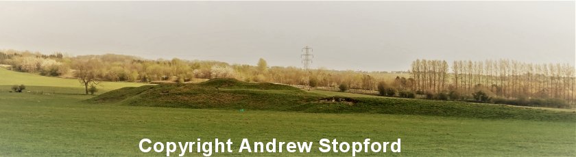
Copyright Andrew Stopford, All rights reserved.
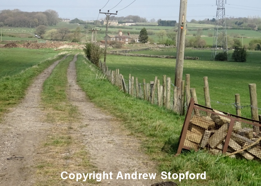
The next photo shows the tubtrack taken from the same position as the photo above, but now the photographer has turned and is looking down towards Clifton.
Copyright Andrew Stopford, All rights reserved.
Continuing our journey along the tubtrack, Ox Close now comes into view. What now appears as two thoroughly modernised homes in the traditional style, where once three cottages, in which the mine manager lived in the one nearest to the camera. It is difficult to imagine how the site would have appeared 100 hundred years ago (when the Low Moor tramway was closed and demolished), or 150 years ago, when there would have been a steam-powered winding engine, a pit (where the brown agricultural material has been dumped to the right) and the line to the southern parts of the system coming in from the right.
Copyright Andrew Stopford, All rights reserved.
In the photo below the waste heap from the original Clifton Colliery features again, and can be seen behind the electricity pylon, with the tubtrack branch trailing into the mainline in the middle distance.
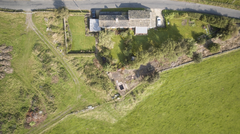
The shot below was taken using a drone, and shows the tubtrack on its low embankment approaching the site of Ox Pit from the south. The formal garden behind the garage and the rough ground to the right marks the site of Ox Pit's colliery yard. When the tracks from Low Moor finally arrived, they crossed the road and passed through the metal farm gate in the bottom right hand corner of the photo. These were of a wider gauge at 3 foot 10.5 inches, and for a time coal would have passed down the 3 foot tubtrack to Brighouse Gas Works or northwards on the 3 foot 10.5 inch gauge to Low Moor steel works. It is also suggested that the incline was dual gauged, with an extra set of rails laid to allow the Low Moor couves to be lowered down into Brighouse. The couves used on this section were of smaller capacity, as there where issues with the height of the tunnel under Clifton Common. It follows that when the lease for the line to Brighouse expired that these couves would have been withdrawn and scrapped, as their smaller capacity would have reduced the efficiency of the main line - which was questionable anyway.
This photo also shows the site of one of the systems level-crossing, the mapping suggesting that two tracks crossing at this point. The 'main line' crossed the lane through the right hand gate. Ian Wood has suggested that in the 1960s there was evidence of waggon-turntables at the entrance to the waggon repair shed (by the left hand gate) but this has been picked-up in the drone photo.
Copyright Rick Hewland, c. 2016
Copyright Rick Hewland, c. 2016
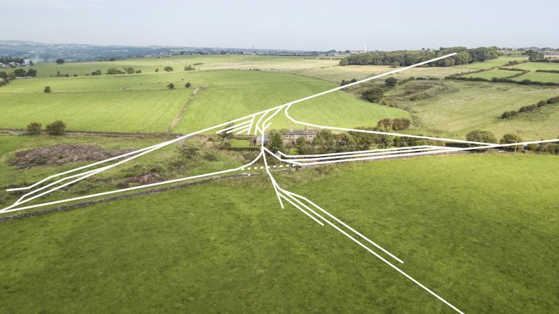
Eventually, Ox Pit was the junction for a number of branches. Using the various mapping sources, it has been possible to superimpose the various tracks on a modern photograph.
The tracks from the left merge to form a single line of rails towards Brighouse and Brake Head. The track appearing from the wood at the top of the picture is the .main line' to Low Moor. The tracks disappearing to the right head up short incline to the site of High Moor Lane Pit, which is now between and under the northern slip-roads for Hartshead Moor Services on the modern M62 motorway. The tracks exiting bottom right ran to Flatts Pit (just short of the modern motorway), with a short extension to the Green Lane Pumping Engine, which on the 1900 mapping is marked s disused. Just before the pit, a further branch headed in an easterly direction to Hartshead Pit, and then southwards to Three Nuns Pit, where it terminated. This latter pit was very close to Cooper Bridge Station on the L&YR Calder Valley mainline between Heaton Lodge and Bradley Wood Junctions, and represents the most southerly point on the system.
The chord between the line from Low Moor that swings round to join the line to High Moor Lane Pit appears to have been laid to speed coal being routed northwards to Low Moor. However, this was a relatively short-lived development, as a direct branch in the direction of Low Moor was constructed from a junction adjacent to Hare Field Farm on Halifax Road at Hartshead Field Top. Once this was completed, the chord was lifted to leave a short siding off the main line.
Copyright Rick Hewland
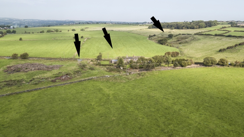
In 2012 the field north of Jay House Lane was ploughed, and the course of the Low Moor Tramway heading north towards Whitaker Pits Wood can be clearly seen. Of even greater interest is the track of the south-to-east chord that initially allowed direct running from High Moor Lane Pit to Low Moor can be seen directly above the rubble of the smithy.
Photographer & Copyright: Anne Hewland
Copyright Rick Hewland
The system appears to have closed with the closure of the Low Moor Steel Works, and the Ox Close title deeds show the buildings being sold off on 1 November 1922. Although unconfirmed, it would appear that the land comprising the colliery yard was never sold, not belonging either to the modern Ox Close, or the adjacent farm.
It will noted in this sale that the land at one time formed the first tramway connection to High Moor Lane Pit has been sold on 1 November 1922, but that the alignment of the later 'main line' to Hartshead and Three Nuns Pit (which can be seen projecting in a south-easterly direction) was retained, and therefore traffic was still able to pass to Low Moor after this date. As the lease of the line to Brighouse gasworks had expired on 29 February 1920, Ox Pit was no-longer a junction. On a visit to Ox Close in 1994 Roy Black [11] suggested that Ox Pit mine was disused by 1907. The Northern Mining Research Society Website shows Three Nuns operated from 1897 to November 1928, so this section of the tramway survived to the end of operations..
The title deeds make reference to the Last Will & Testament of Sir George John Armytage Baronet, and the retention of the mineral rights by his estate. This document also protects the pillar of coal that Ox Close sits on.
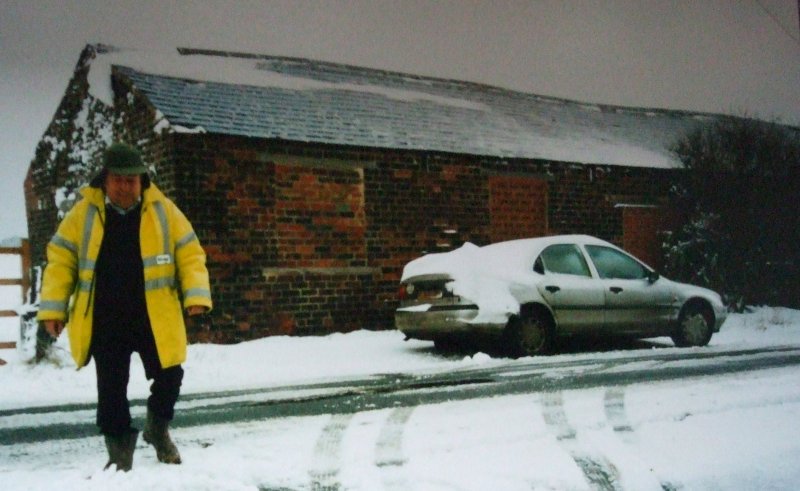
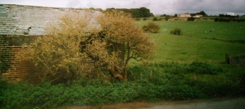
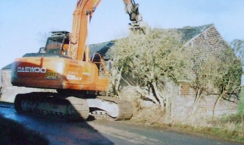
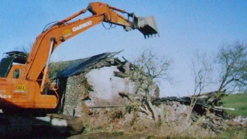
The three cottages on the southern side of the road were part of the mining complex. Across the road, as shown on the title deeds above, was a large oblong brick-built building. This reputedly housed the blacksmith, with stabling for the horses at the eastern end. It is understood that the blacksmith continued his trade from the building after the tramway was demolished in 1928. In Margaret Sharp's 'Down the Acres' [8] Pat Tattersall, when talking about her childhood at Jay House Farm in the 1950s, notes: "...most of the farm machinery was stored in the the old engine shed at Ox Pit, separate room at the end was used for potato storage" (my italics). The reference to it being an engine shed is interesting, as there is no evidence of locomotives being used south of Cow Close Lane, and the mapping examined covering for the period 1854 - 1922 fails to show any direct rail connection to the building, although rails ran past the western end at right angles to the building. The building was demolished in 2008, and I am grateful to Anne Hewland for these shots illustrating various aspects of the building before its demise. The potato room can be glimpsed in final photo of the demolition.
Photographer & copyright: Anne Hewland
Photographer & copyright: Anne Hewland
Photographer & copyright: Anne Hewland
Photographer & copyright: Anne Hewland
Photographer & copyright: Anne Hewland
These two shots record the demise of the building.
Photographer & copyright: Anne Hewland
Photographer & copyright: Anne Hewland
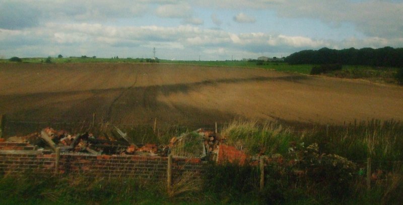
A photograph of the Green Lane Pumping station and part of its reservoir appears in Margaret Sharps 'Down the Acres' [8]. The photo shows two brick built buildings very much in the stile of Low Moor pit head buildings elsewhere, with a substantial square brick built chimney to the right of them. In the background are two further buildings, the nearer one of wooded construction. Above the reservoir wall four corves can be seen standing together.
Low Moor Tramway: History Low Moor Tramway: Route Low Moor Tramway: Track & Inclines Low Moor Tramway Mapping

Copyright J K Wallace, t/a 'Hall Royd Junction' 2013-2023 email: Hall Royd Junction
7 Portobello Close, Chesham, Bucks. HP5 2PL, UK
tel: +44 (0)7513 412880