
Liverpool - Southport Line: Hall Road - Blundellsands & Crosby
(Merseyrail Northern Line)
Our journey today starts at Southport Chapel Street and follows the line to the site of the erstwhile Liverpool Exchange using Google Streetview images. Should you use the individual Google navigation tools, and wish to restore the page to its default views, just refresh the page.
As it takes a few seconds for each of the Google maps to be retrieved, the line is broken into sections, and generally these are station-to-station. Each Google Streetview image is presented facing the direction of travel, in this case southwards. The intention is that to see the northwards view, the Google navigation tool needs to be used.
Hall Road was the point that trains could be turned back to Liverpool Exchange, and a reversing siding was provided between the two running lines. There was also a maintenance depot here, which was upgraded when the Meols Cop electric car workshops were closed in Southport. However, as this view shows, Hall Road has now also closed, maintenance moving to Birkenhead.
The view southwards from Hall Road level crossing, but reversing the vew shows Hall Road station and footbridge.
Blundellsands & Crosby Station is visible fromThe Serpentine which parallels the railway.
Blundellsands & Crosby Station from the car park.
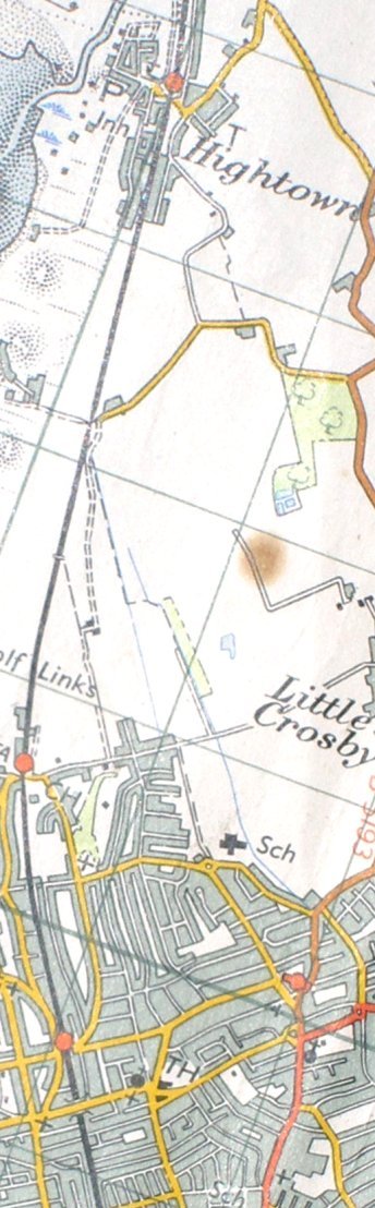
Reproduced from the 1961 Ordnance Survey map.
Click here for the line southwards to Bootle & Liverpool Exchange
Copyright J K Wallace, t/a 'Hall Royd Junction' 2013-2023 email: Hall Royd Junction
7 Portobello Close, Chesham, Bucks. HP5 2PL, UK
tel: +44 (0)7513 412880